A Google Maps user stumbled upon an unsettling sight in the heart of the Pacific Ocean. Last October, Reddit was abuzz with conspiracy theories when user Kokoblocks shared an image of a dark mass in the Pacific. This peculiar “black hole,” spanning 56 acres, raised eyebrows worldwide. However, it wasn’t a void; it was Vostok Island, an uninhabited territory belonging to the Republic of Kiribati.
Accompanying the Reddit post was the caption, “what the F**K this looks nothing like an island,” sparking a flurry of speculation.
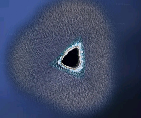
Theories abounded, with some likening the enigmatic spot to the island from the TV series “Lost,” while others mused about the Bermuda Triangle’s relocation.
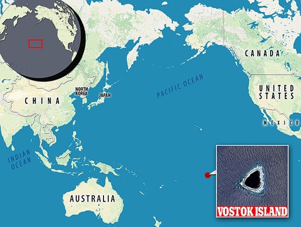
In truth, the seemingly void expanse was Vostok Island, located some 400 miles from Tahiti, amidst the Southern Line Islands.
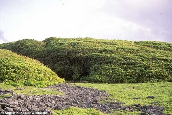
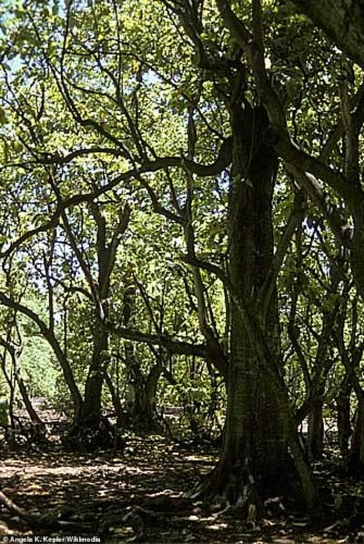
“It’s actually dense foliage, appearing black from above due to Pisonia trees,” elucidated one Redditor.
These towering trees, reaching heights of up to 100 feet, form a thick canopy, giving the illusion of a singular dark entity.
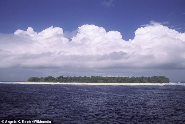
Some skeptics suggested censorship, citing Google’s practice of obscuring sensitive sites. However, Live Science clarified that the black patch was merely a densely wooded area on the remote island.
Vostok Island lies approximately 4,000 miles east of Australia and 1,500 miles west of Hawaii, forming part of the southern Line Islands chain, which includes Malden, Starbuck, Flint, and Caroline.
Discovered in 1820 by Russian explorers aboard the ship Vostok, the island garnered attention for its guano deposits, leading to its US claim in 1856. Later ceded to Britain, it became part of Kiribati upon the country’s independence in 1979, designated a wildlife sanctuary since then.
In 2009, marine biologist Enric Sala spearheaded an expedition to Vostok, aiming to study its marine life and natural resources.